
Page 29 - Журнал Sozvezdye Review - «СОЗВЕЗДИЕ» #36
P. 29
Международная наука
и управление льдами
International Science
and Ice Operations
Таким образом, проект позволит провести Application Platform (SNAP). In parallel, the scien-
комплексные исследования на базе объединения tists at Finnish Meteorological Institute are work-
интеллектуальных и инфраструктурных ресур- ing to develop algorithms for identifying sea-ice
сов партнеров из России, Норвегии, Финляндии hummocks based on high-resolu-
и Швеции, что позволит получить актуальные tion SAR images. Once in place,
знания о прогнозных ледовых нагрузках в север- these algorithms will make it C 2020 года эксперты
ных морях и выработать решения по снижению possible to map and keep statis- САФУ начали работу по
рисков хозяйственной деятельности при освое- tical record of the emerging ice
нии арктических территорий. hummocks. использованию снимков
со спутников TerraSAR-X,
Comprehensive research Sophisticated modeling TanDEM-X и Sentinel-1 для
Designed to increase the knowledge of ice con- In 2020, the project has pro- анализа топографических
ditions and to improve the sea ice forecast models, duced its first sea ice modeling re- характеристик территории
IceOps seeks to promote the industrial development sults, based on multi-criteria anal- Since 2020, the project team at
in the Arctic areas, contribute to ensuring mining ysis, to assess the economic risks. It
and environmental safety and facilitate marine ac- used fuzzy logic to forecast the ice NArFU have been obtaining images
cessibility. situation in the Pechora Sea. The from TerraSAR-X, TanDEM-X
IceOps unfolds within four basic activity areas: ac- analysis covered also the northern
cumulation of data, including remotely sensed, on the and the western sectors of the Bar- and Sentinel-1 satellites to analyze
Barents and Pechora sea ice conditions; field studies and ents Sea. the topographic features of the
geophysical research; laboratory analysis of field data; The project team at Luleå Uni- target area
and simulation of ice mechanics and marine operations. versity of Technology are testing
By using modern computational techniques and com- the physical properties of differ-
bining various data sets – on physical properties of ice, ent types of ice and evaluating the
SAR data, historical data for Arctic sea ice – the project parameters of ice-structure interaction. A number of
has as its outcome a comprehensive description of the simplified models for calculating the sea ice impact SOZVEZDYE #36
impact the ice may have on offshore structures and the on structures have been developed by SINTEF Nar-
related economic risks. vik. These models take due consideration of the type
In place are the reports covering the Barents sea of ice and its dynamic performance. исследования
ice conditions, prepared by experts of NArFU. The The project continues its activities. Year 2021 exploration
obtained SAR images have been verified against the will see the team going on a number of expeditions.
actual ice conditions as observed by project team The final results will be presented at internation-
from NArFU Arctic Floating University 2019. al venues – Arctic Engineering School (September
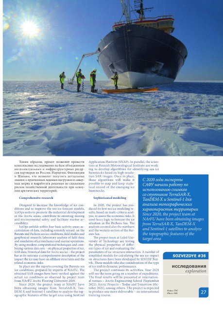
Since 2020, the project team at NArFU have 2021), Arctic Projects – Today and Tomorrow (Oc-
been obtaining images from TerraSAR-X, Tan- tober 2021), among others. The project is expected
DEM-X and Sentinel-1 satellites to analyze the top- to produce one more deliverable – an international Фото: FMI 27
ographic features of the target area using Sentinel training course. Photo: FMI